May 2023
- Details
- Parent Category: resources
- Published on Thursday, 26 August 2021 15:29
Teaching foundational coding skills through the CODE-GEO program
Using Computational Infrastructure for Geodynamics (CIG) software requires some crucial background knowledge in coding. For example, numerous CIG codes, like ASPECT and PyLith, operate with a command-line interface such that basic skills in using the terminal are necessary. To help fill such knowledge gaps for students from underrepresented groups at the undergraduate level, the CODE-GEO (Collecting Observation for Data Encoding in the Geosciences) program was developed at Virginia Tech by Associate Professor D. Sarah Stamps in 2018. CODE-GEO is a week-long coding camp for undergraduate students from underrepresented groups in STEM with little to no coding experience, but who want to learn. Participants gain fundamental and transferable coding skills, as well as useful techniques in cultural effectiveness like active listening and how to interrupt implicit bias in the workplace.
History and Program Content
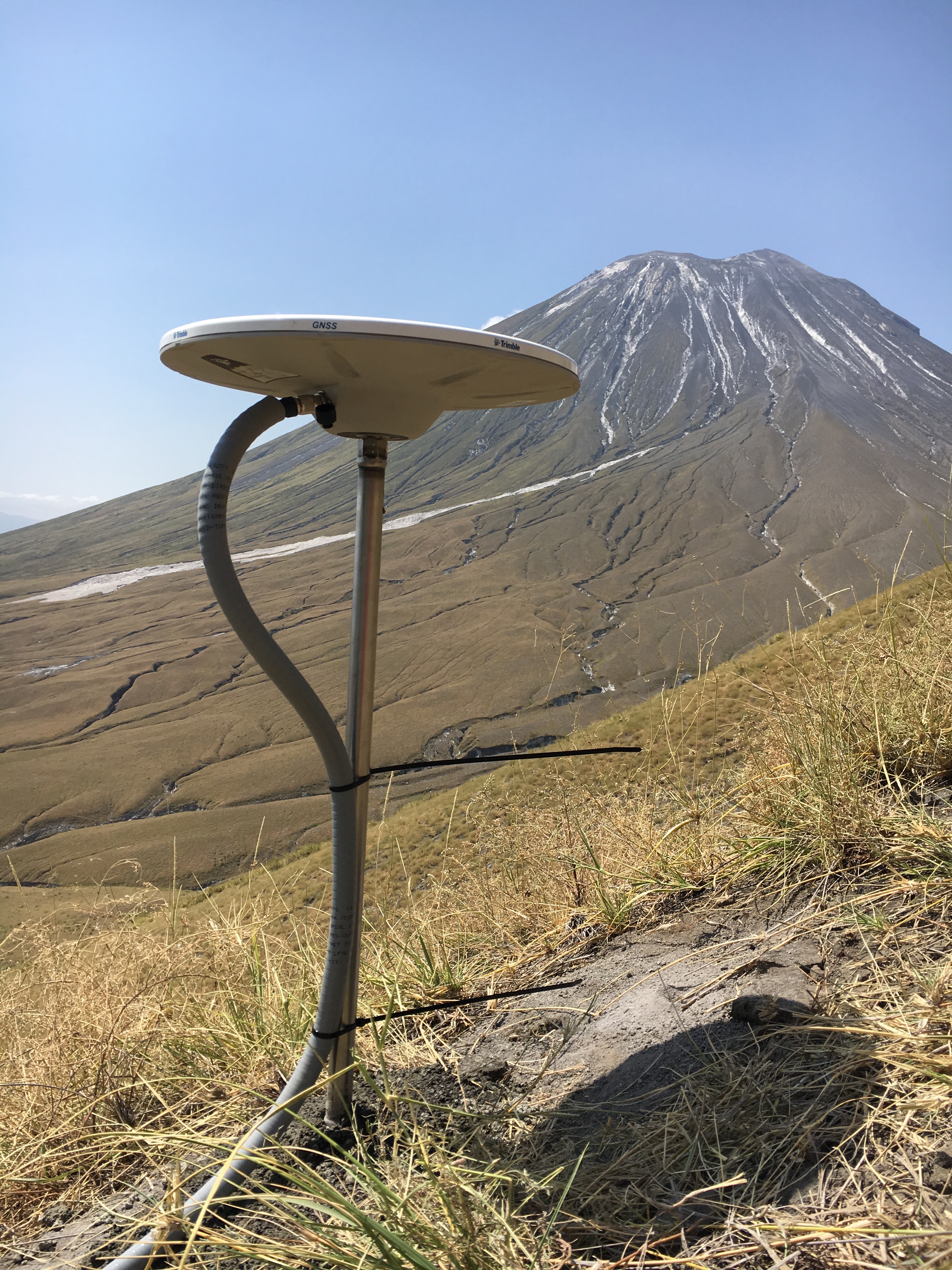
CODE-GEO began in 2018 with 4 in-person participants as a Spring Break program through a collaboration between Hampton University and Virginia Tech funded by the Virginia Tech Institute for Creative Technology and Applied Sciences’ (ICTAS) program. The 2018 version of CODE-GEO had a scientific focus on coastal subsidence in the Hampton Roads area of Virginia (news story). The revised CODE-GEO program is funded by Stamps’ National Science Foundation CAREER award (#1943681) for years 2021-2025 with a scientific focus on volcanic hazards assessment surrounding the active volcano Ol Doinyo Lengai in Tanzania (Figure 1). The 2021 program took place with 5 participants May 24-28 virtually with synchronous instruction. Topics covered in the 2021 program included developing skills in using the Linux terminal, shell scripting, data analysis, Generic Mapping Tools, cultural effectiveness, and online collaboration. The 2022 program took place February 28 - March 4 at Virginia Tech in Blacksburg, Virginia with 4 participants. Topics covered in 2022 included using the Linux terminal, shell scripting, data analysis, Generic Mapping Tools, Jupyter Notebooks, Python, cultural effectiveness, and online collaboration. In 2023, the program was held online with synchronous instruction for 5 participants and followed a similar program as the 2021 version of CODE-GEO, but also incorporated lessons in digital organization and time management.
Impact and Future PlansFormer participants of the CODE-GEO program have gained useful knowledge from the program, like a 2018 participant who is now working in the information technology industry said “The skillsets I learned in CODE-GEO were transferable and have been beneficial in my current position. I've been able to utilize and enhance my understanding of coding and use various techniques to analyze and interpret data for our company.” A 2021 participant said “I am extremely grateful for the CODE-GEO, which improved my comfort with computer science. I became more comfortable problem solving and accessing the widely available tools for geosciences.” Recently, the CODE-GEO program caught the attention of the University of Texas, Austin’s summer program called STRONG: Summer Institute on Inclusive Research Mentoring and Inclusive Communication of Science. In mid-June 2023, CODE-GEO will be taught in-person for the STRONG program by PhD candidate Ms. Karen Williams and postdoctoral scholar Dr. Emmanuel Njinju. Given the positive responses from prior CODE-GEO participants and the expansion of the program audience to include STRONG participants, Stamps will be seeking new avenues for the program to continue beyond the conclusion of her CAREER award funding.
Contributed by: D. Sarah Stamps, Virginia Tech, Department of Geosciences, Geodesy and Tectonophysics Laboratory

Figure 1. Photo of the active volcano Ol Doinyo Lengai in Tanzania with a GNSS station in the foreground. Credit: D. Sarah Stamps.
